
Did you know you can view/use ESRI basemaps in Google Earth Web and Pro? I had forgotten about ESRI’s KML/KMZ map service capabilities until someone asked me if it was possible to use/view USGS topo maps in Google Earth. Many people are familiar with Google Earth and want to have other basemap options to use. This is a short post on how to bring in ESRI basemaps in Google Earth Pro (desktop) and Google Earth Web.
I’m using Google Earth Pro version 7.3.2.5776 on my laptop. The Google Earth Web is of course the browser version and works best in Chrome. Google Earth Web also works with Firefox (v. 73.0.1) and the new Microsoft Edge browser (released Jan. 2020) but not the older Edge Legacy browser. If you are using Google Earth Pro then I assume that you already have it installed on your machine.
Go to ESRI Basemap REST Services Page
https://services.arcgisonline.com/arcgis/rest/services
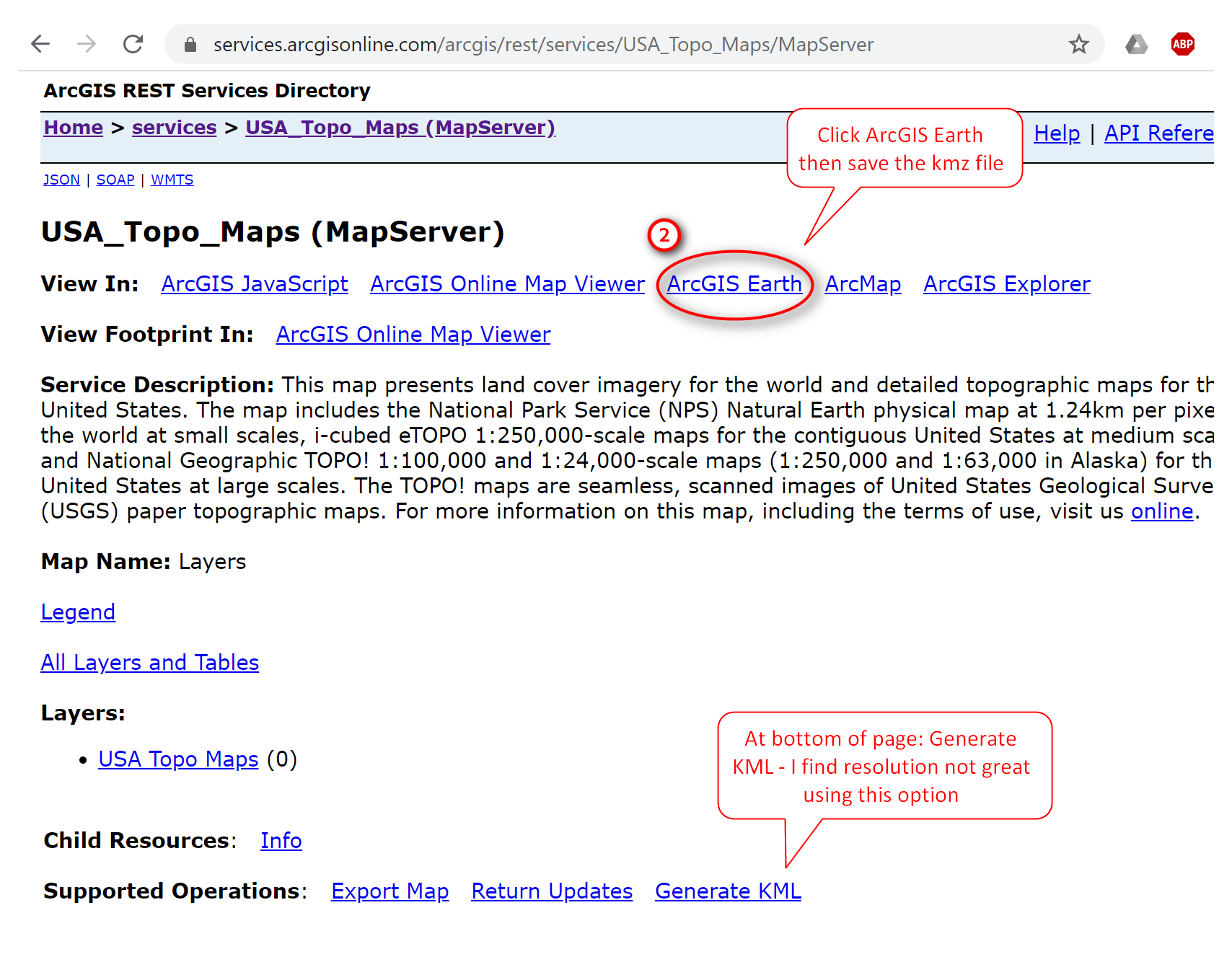
Here you’ll see a list of available map services. Click on a map service of interest - it will open in a new tab. Then click on ArcGIS Earth option to download/save the kmz file.

Here I’m looking at the USA_Topo_Maps Map Server Service. If you look further down the page, you’ll see that there an option to Generate KML - I find this option to not produce very good resolution when used - at least not with these map services. So I recommend using the ArcGIS Earth option. To find out more about about KML output and operations from ArcGIS REST API, see this link here.
ESRI KMZ Basemaps in Google Earth Pro
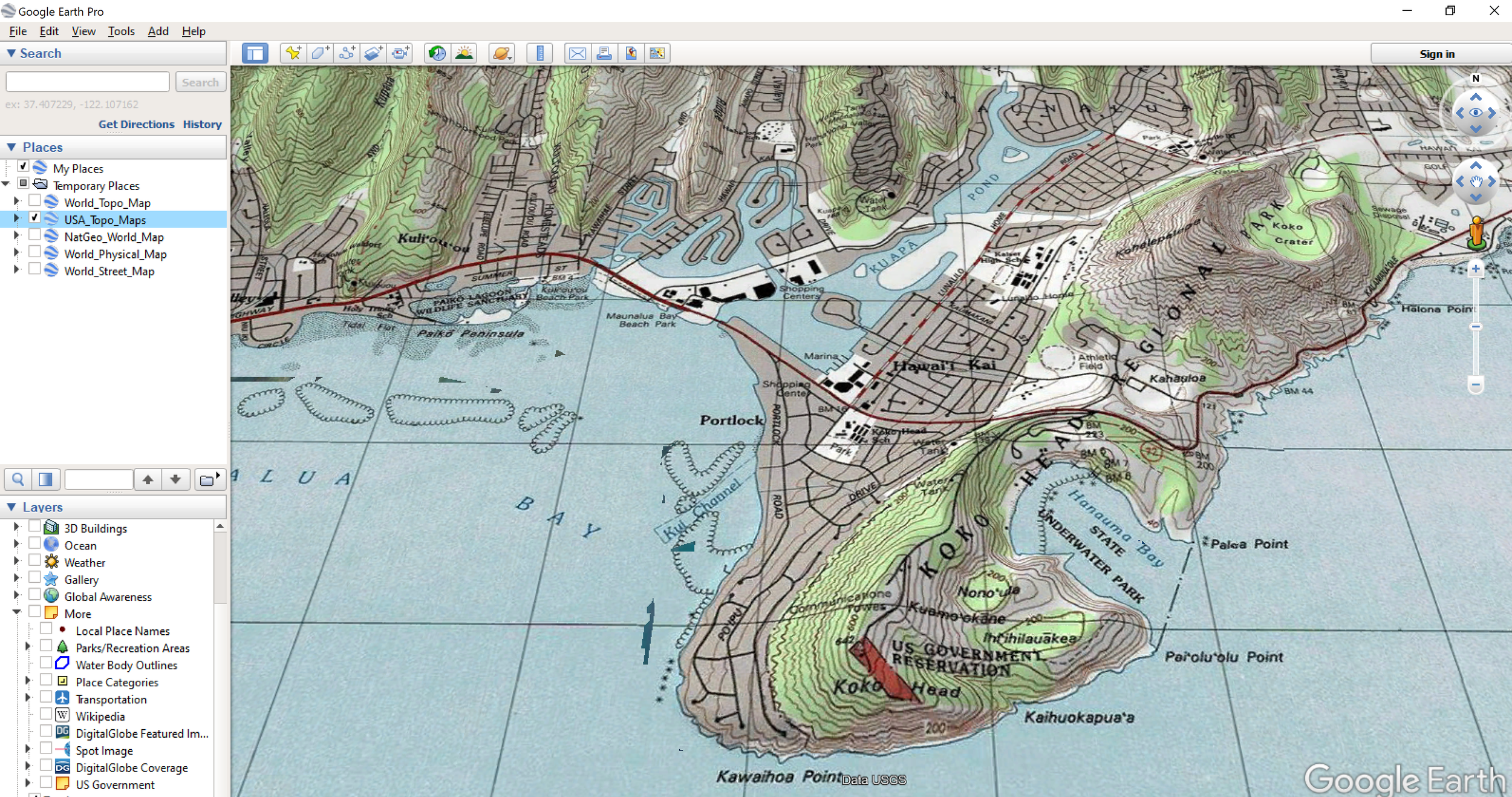
After saving the KMZ file, double click on it to open it in Google Earth Pro. In GE Pro it will add the MKZ to your temporary places. If you want to save the KMZ file to “My Places” then right click on the KMZ file and Save to”My Places”.
Here’s an example of what it looks like in GE Pro.

Below is a snapshot of the USA_Topo_Maps KMZ as seen in GE Pro. The resolution looks great.
ESRI KMZ Basemaps in Google Earth Web
For Google Earth Web, you don’t have to download anything. Just type in the following URL into the browser of your choice. Remember, that it works best in Chrome, but you can also use Firefox and the new Microsoft Edge (Canary).
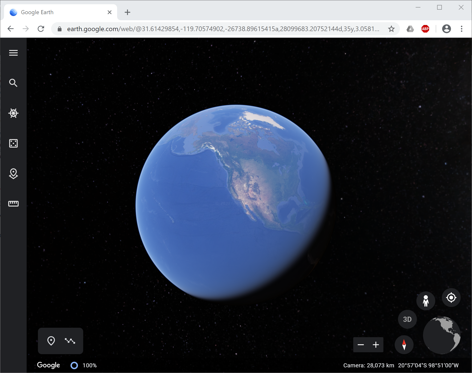
Google Earth Web: https://earth.google.com/web/
You should see something like this. I haven’t had the chance to try out all the cool things you can do, but I really like the Google Earth Web version.
In Google Earth Web, you have to set up some options first before you can use/view the ESRI KMZ files. In the left hand panel, click the Menu button then go to Settings Options.

In the Settings options, switch on the option to Turn on KML File Import then Save the settings. You’ll get a pop up asking if you will allow earth.google.com to store data in persistent storage? — Click Allow.

Back in the Menu, go to Projects. Note you can also access Projects using the Projects button in the main menu panel. In the Projects panel, click the Open button and select one of the Import option based on where you saved the ESRI KMZ files you downloaded.

Here are two example of my ESRI basemap KMZ files. Note there are some display options available for the KMZ files.

There are also some map styling options you can set as well (under Map Styles when you click Menu button).

Here is a view of the ESRI USA_Topo_Maps KMZ file with the 3D building option turned on and viewed in 3D in Google Earth Web.

That’s it for this post. Thanks for reading…until next time.