


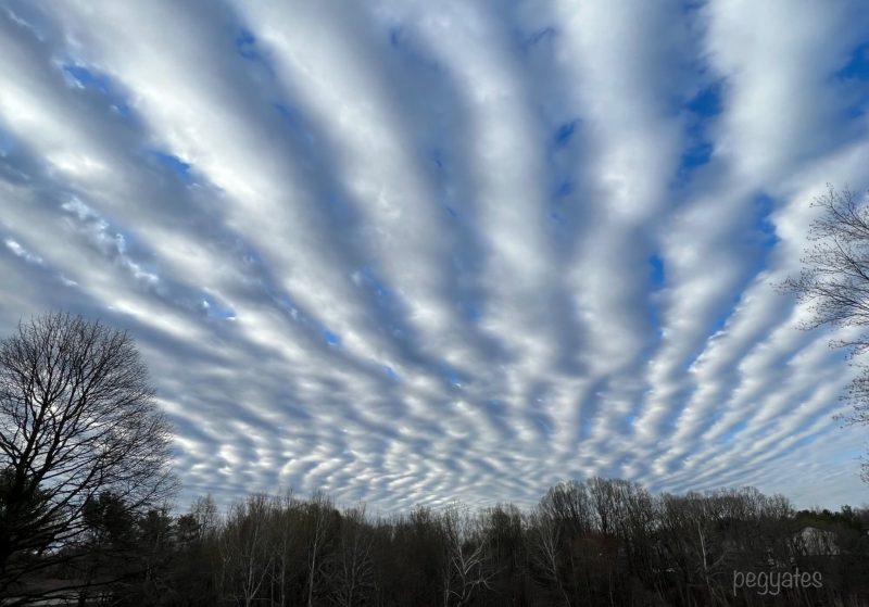
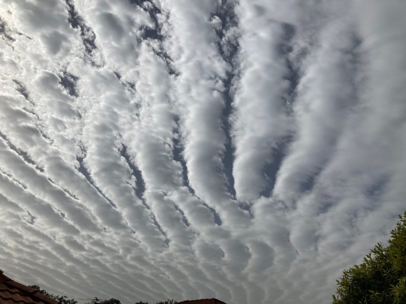
What are undulatus clouds?
Undulatus clouds are wavy, undulating clouds that have a rolling appearance. These clouds are either the puffy cumulus variety or the thinner, sheet-like stratus variety. Overall, the most common form of undulatus clouds that people usually spot is the altocumulus undulatus. They appear, uniquely, as mid-altitude rolls arranged in parallel rows. As an illustration, you might think of them as giant bars of a cage stretched overhead.
Generally, you’re more likely to see distinct lines in the cumulus type of undulatus clouds. The stratiform version appear more like a wavy sheet.
How do undulatus clouds form?
Undulatus clouds form perpendicular to the direction of the wind. More specifically, a lifting, large air mass spurs the formation of these clouds, which may be followed by condensation and possible instability. Also, pilots recognize undulatus clouds as a sign of wind shear. Consequently, these clouds may create slight turbulence for a flight.
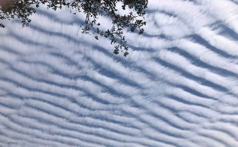
Undulatus clouds can, however, confuse viewers because they appear similar to cloud streets. Read more about cloud streets here. Undulatus clouds form perpendicular to the wind, while cloud streets form parallel to the wind.
As the Cloud Appreciation Society said:
Cloud streets are always aligned with the wind. They run parallel to the wind direction. This differentiates cloud streets from the similar-looking low formation known as stratocumulus undulatus, which always runs perpendicular to the wind. So why do these two distinctive cloud formations line up in different directions? Because the two clouds patterns, though similar in appearance, develop in quite different ways.
The lines of stratocumulus undulatus clouds run perpendicular to the flow of air because they develop in what are known as ‘shearing winds’. This is when the windspeed increases markedly with height. It can lead to a sort of ‘ruffling’ of the air between, coaxing it into wave-like ridges of rising and dipping air, like a rug bunching up as it is slid along the floor. Not only are the lines of these clouds perpendicular to the wind, they also tend to appear as more continuous stripes of cloud compared with the serried ranks of individual cumulus in cloud streets.
Cloud photo gallery
Bottom line: Undulatus clouds look like wavy rows. Formed from puffy or thin clouds, they reside in the atmosphere high up, at mid-levels or closer to the ground.
Like what you read?
Subscribe and receive daily news delivered to your inbox.
More from
Kelly Kizer Whitt


