
If you pay close attention, shelterbelts have an interesting story to tell.
“Windbreaks of the Great Plains” is the latest Story Map website put together by the United States Department of Agriculture (USDA) National Agroforestry Center in Lincoln, Neb., along with other federal and state agency partners. This map tells the story of these plantings, starting with the history of the Dust Bowl and the Prairie States Forestry Project.
One of the map’s research tabs, titled “The Dirty Past,” tells the harrowing tale through lyrics from Woody Guthrie’s song, The Great Dust Storm, along with a photograph of one of the great dust storms that pummeled portions of the Midwest in the Dirty Thirties.
“The storm took place at sundown. It lasted through the night, when we looked out next morning, we saw a terrible sight. We saw outside our windows where wheat fields they had grown, was now a rippling ocean of dust the wind had blown,” Guthrie’s song croons.
Todd Kellerman and Gary Bentrup have both studied the Dust Bowl and clearly understand the implications it had on shaping agriculture’s history. In their roles, they help farmers and ranchers recognize that practices mitigating these types of conditions must not be a thing of the past but should continue to be applied to ensure there are productive lands for generations to come.
“I grew up playing in shelterbelts around the family farm in Western Kansas and I have always been interested in how we can use trees and shrubs in agricultural landscapes to accomplish a variety of purposes,” said Bentrup, a research landscape planner at the USDA National Agroforestry Center.
Bentrup’s work focuses on developing tools and resources for designing multi-functional agroforestry practices that provide production and environmental benefits.
Kellerman serves as a GIS (Geographic Information System) specialist at the Agroforestry Center and his work involves incorporating geospatial tools. His specific areas of interest are multifunctional planning of agroforestry systems, variable-width buffers for water quality, agroforestry mapping and inventory, and web-based mapping for outreach and technology transfer.
“My interest in maps and using geographic data to solve complex problems led to a career using GIS for natural resource planning and conservation,” he commented.
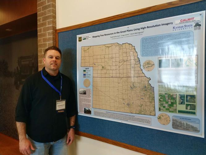
Kellerman said the USDA National Agroforestry Center and its federal and state agency partners are very excited about the development of its first-of-its-kind high-resolution tree cover map for Nebraska and Kansas.
“Any type of large-scale inventory of agroforestry practices, including windbreaks, is sorely lacking,” Kellerman explained. “Knowing how much is out there and what the trends are is useful information … While the date is available in GIS format, we want other ways to not only show this data, but tell the story of these resources. The Story Map allows users to interact with geospatial data on a user-friendly web platform.”
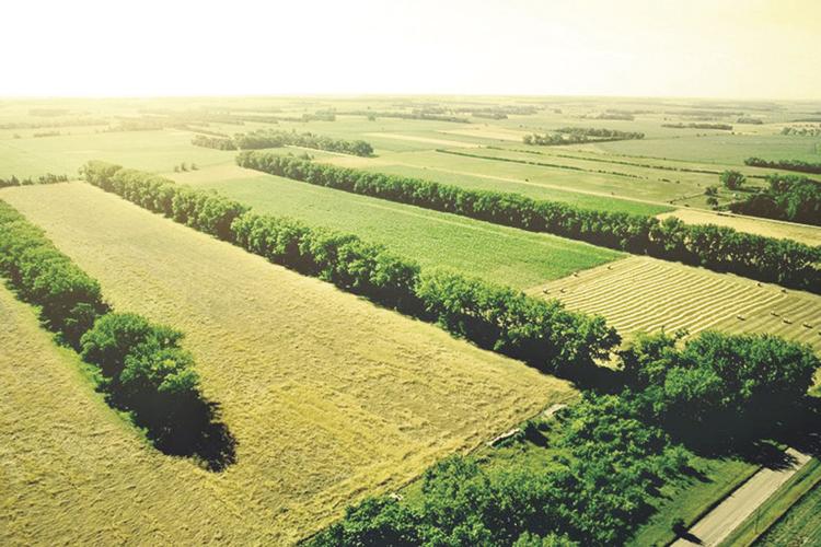
The interactive mapping section allows website visitors to compare the original windbreak planting locations with today’s current landscape, as well as view a high-resolution tree cover map of Kansas. There is also information about some of the innovative, and lucrative, uses for windbreaks.
“Some trees and shrubs can produce fruits, nuts, fuel, fodder or materials for crafts that can be sold or processed in order to diversify farm income,” he said. “In these cases, the crop is harvested from the trees and shrubs in a manner that does not impair the shelterbelt function. Careful design is required to reduce potential conflicts between management of the crop field and the windbreak.”
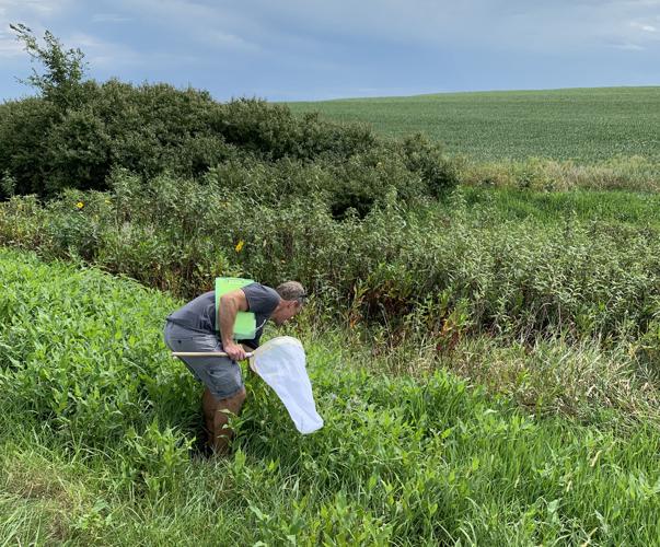
Other specialized windbreak uses include pollinator habitats and field buffers for organic production.
Kellerman said that to support pollinators, windbreaks should include a variety of plants that bloom at different times of the year, to provide food for longer periods. Plants that are used for bee nesting or provide undisturbed soil for ground nesting bees are also important, he added.
People are also reading…
A vital function for pollinators, Kellerman explained that shelterbelts can also be designed to intercept pesticides and chemical-laden dust to protect organic production fields and active pollinators — both wild and domesticated.
All windbreaks, despite their purpose, need regular maintenance, Bentrup stressed.
“Knowing the primary tree and shrub species in one’s windbreak is important because one can focus on the issues regarding these species,” Bentrup said. “This may only be three or four species and each one may only have one or two real problems to keep an eye out for.”
He suggested performing several checkups a year, walking or driving alongside the windbreak to look for problem areas. Consider the following when examining a windbreak: Are the trees getting enough or too much water? Are trees getting enough sun? Do you see signs or symptoms of disease? Do you see damage from insects, livestock or wildlife? Are weeds choking out trees?
Sanitation is key to avoiding serious issues, he continued. Removing diseased or dying trees as soon as possible will prevent insects and contamination of neighboring trees. Be sure to sterilize pruning equipment before using any tools on healthy trees.
“In some cases, complete reestablishment of a windbreak may be a better option than renovation,” Bentrup added. “Begin planning the windbreak in the fall before the anticipated spring planting. Fall is the time to prepare the site, arrange for nursery stock, and provide for weed control. Any roots, stumps and foreign materials must be taken care of so they do not cause problems with the tree planting process.”
Kellerman and Bentrup outlined two primary USDA programs that provide assistance for windbreak establishment and renovation. The USDA Natural Resources Conservation Service has the Environmental Quality Incentives Program (EQIP), which provides financial and technical assistance to address natural resource concerns and delivers environmental benefits such as improved water and air quality, reduced soil erosion and sedimentation or improved or created wildlife habitat. Financial assistance covers part of the cost from implementing conservation practices such as windbreaks.
The Continuous Conservation Reserve Program (CCRP) is a land conservation program administered by the USDA Farm Service Agency (FSA). In exchange for a yearly rental payment, farmers enrolled in the program agree to remove environmentally sensitive land from agricultural production and plant species that will improve environmental health and quality. Contracts for land enrolled in CRP are 10 to 15 years in length. Windbreaks have historically been included in CCRP, although the current sign-up does not include them as eligible practices. Riparian Buffers are included in the current CRP sign-up.
“Contact your local county USDA Service Center to learn more about the available programs in your state,” Bentrup said. “State forestry agencies may also have programs to support windbreak establishment and renovation. Check with your state forestry agency to see what programs may be available.”
Kerry Hoffschneider can be reached at editorial@midwestmessenger.com.
Related links:
Visit the Story Map, “Windbreaks of the Great Plains,” by visiting: https://usfs.maps.arcgis.com/apps/MapSeries/index.html?appid=ceb1a9f56acb480a944b9fada7ec258e
Depending on the condition of the windbreak and one’s objectives, there are several renovation approaches available which are described in this handout: https://www.fs.usda.gov/nac/assets/documents/morepublications/ec1777.pdf
A handout that provides more information on windbreak establishment: https://www.fs.usda.gov/nac/assets/documents/morepublications/ec1764.pdf
More information on shelterbelts and windbreaks can be found at the USDA National Agroforestry Center (NAC) website: https://www.fs.usda.gov/nac/practices/windbreaks.php.
The NAC website also provides information on other agroforestry practices including riparian forest buffers, alley cropping, silvopasture and forest farming: https://www.fs.usda.gov/nac/index.shtml.


